Infrastructure Technology Podcast: How LiDAR is changing infrastructure project monitoring
Key Highlights
- Drone-based LiDAR can provide a comprehensive view of large infrastructure projects: Roads and Bridges Staff Writer Jessica Parks interviews Travis Howell from WSP and Cameron Richards from the North Carolina Turnpike Authority on how North Carolina’s Complete 540 Phase 2 project is using drone-based LiDAR to allow teams to capture detailed topographic information across an entire construction corridor rather than relying solely on conventional, ground-based surveying.
- Drone technology can reduce the need to put surveyors in active construction zones: Howell and Richards explain how capturing information remotely helps limit workers’ exposure to construction hazards while providing extensive measurements across areas that would be difficult or time-consuming to survey on foot.
- Data management and coordination are critical to successful implementation: The companies identified flight scheduling, communication between project partners and finding an effective platform to store and access large amounts of data as key challenges during implementation.
- Drone-based LiDAR is not necessarily the right fit for every project: Agencies should consider the project's scale, schedule requirements and intended applications before adopting the technology.
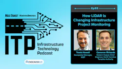




Episode 55 of the Infrastructure Technology Podcast explores how emerging technologies are helping transportation agencies improve project oversight, safety and operational efficiency. The episode examines the North Carolina Turnpike Authority’s use of drone-based LiDAR on the Complete 540 Phase 2 project, where detailed aerial data is helping teams track construction progress, compare field conditions against project schedules and reduce the need for surveyors to enter active construction zones.
The episode also looks at the future of artificial intelligence in public transportation, including MIT Transit Lab’s $2.1 million Google.org grant to support development of the Public Transit Intelligence Hub. The AI-powered platform aims to integrate real-time monitoring, operations control and passenger communications, helping transit agencies respond to service disruptions and make more informed decisions.
Episode length
40:00
About the guests
Travis Howell is the geospatial manager at WSP in the U.S.

Cameron Richards is the eastern deputy chief engineer at the North Carolina Turnpike Authority.

Here is a transcript from the episode:
BL: You are listening to my voice once again to kick off the ITP, which means the dynamic duo is back. Brandon Lewis, Jessica Parks from Mass Transit and Roads and Bridges. Jess, how's it going today?
JP: It's going great. Yes, the dynamic duo has returned. Gavin is a very busy man. He actually, I'm very jealous of him for this work trip. He is in Singapore for a conference that he's presenting at. So yeah, all the best travels to him. Can't wait to hear about his trip. He'll have to share his adventures with us when he returns.
BL: How lucky are we in Endeavor B2B to get to travel internationally? Gavin's in Singapore. Last month. my boss, Editor in Chief of Mass Transit, Megan Perrero, was in Berlin. I mean, we got the best job in the world.
JP: We do. I got to get on my first Endeavor International trip. So far I've just done Vegas twice, which you can't complain. It's a fun place, too. It's got some international elements with its fake gondola rides in the Eiffel Tower.
BL: Unless, of course, your name is Gavin Jenkins, who has professed multiple times on this show his hatred for the Sin City, but I know that Maz is already killing us. This thing's already getting off the rails. So Jess, you have an interview today that we're going to get to. Can you tell us who you are interviewing today?
JP: Yes. So I interviewed Travis Howell. He is the UAS Team Lead at WSP in the U.S. If you don't know what UAS means, it means unmanned aircraft system, so he works with drones. And then I also, it was a dual interview. I also spoke with Cameron Richards from the North Carolina Turnpike Authority. He is their Eastern Deputy Chief Engineer. What we discussed was the use of drone-based LiDAR on the Triangle Expressway project in North Carolina. It's a really interesting one, so I hope you guys enjoy it.
BL: We're going to get to that in a minute. But first, Jess, I got a little Mass Transit news that came across my news desk here in the last week or so, and this one's interesting because it comes from the Massachusetts Institute of Technology, MIT, those smart people over there. The MIT Transit Lab, they have been awarded 2.1 million in funding from Google, our friends at Google, to support public transportation agencies, real-time monitoring operations control and passenger communication systems into a single centralized AI orchestrated platform. This project is known as the Public Transit Intelligence Hub or PTIQ for short. It's part of a total of $30 million in funds that Google awarded to 15 recipients for the google.org impact challenge, AI for government innovation. And selected from a global poll, more than 2,600 proposals. Google says the projects are selected to support governments that are addressing complex challenges using AI. Now with this project, MIT says it will build on the group's decades of experience and apply research collaborations with transit agencies in major metropolitan areas throughout the world, and it will support interface for control center staff that will integrate predictive models, optimize engines and large language model based contextual reasoning. This is a potential game changer in my opinion in the transit agency. We know that agencies for really the last couple of years starting in 2025 have been using AI in their systems, but this is really going to be sort of an overarching AI model that most agencies in the U.S. can use potentially down the line to help with operations and other things such as passenger communication. Jess, what are your thoughts on this?
JP: I think it's a really interesting program because public transit has a lot of uses for AI with the timing of trains, everything, scheduling, everything like that. So I see it as a benefit because I think that a lot of public transit agencies as most companies and everywhere are stretched thin, and it's hard to be able to implement the AI into these tasks and workflows, so I think having the support of MIT to be able to build something in a way that will fulfill their needs and they can optimize it, that works best for them, but it's already mostly suitable for them. I think that will be beneficial to integrating AI into their workplaces because I just don't think they have the time or the means to do it, a lot of these agencies.
BL: One of the biggest things we talk about with public transit is obviously service. And when it comes to delays, when it comes to bus routes, railroads, if there's accidents, if there's delay, if a bus is running behind, etc., the goal of this is essentially to transform the transit workforce experience, the rider experience, the overall ability of transit agencies to effectively respond to disruptions and unexpected events in real time without having somebody necessarily on the ground, which does relate Jess a little bit to your interview today.
JP: Yes, definitely. So yeah, my interview today, I'm excited too because it's really just giving the agency the ability to look at a whole project as opposed to just being piecemeal, so it definitely does relate a little bit.
BL: And with that, Maz, let's go ahead and kick it over to Jess's interview about LiDAR.
JP: Thank you guys for listening to the ITP. Today I'm joined by Travis Howell from WSP in the U.S. and Cameron Richards from the North Carolina Turnpike Authority. Thank you both for joining me today.
TH: Thank you. Excited to be here.
CR: Glad to be here.
JP: Awesome. I’m excited you guys could join me. So I wanted to see if you guys could start by giving our audience a little bit of an overview of the Complete 540 Phase 2 and why this project is so important to the Triangle region. I think that might be a question for you, Cameron, and you can jump in, Travis.
CR: Yeah, happy too. So the Complete 540 Phase 2 project, it completes the final 10-mile segment of the 540 loop around the greater Raleigh area in North Carolina, so it's ultimately an extension of the existing Triangle Expressway system that is part of that 540 loop, and it's extending it to about 37 miles. But ultimately closing that loop is a big milestone for that region. Ultimately, the project, it's going to be a six-lane fully controlled access toll facility. It features six new interchanges and really some of the latest in tolling technology as part of that facility. And so when we think about the benefits for the region, ultimately we want to improve mobility, free up and reduce congestion and some of the nearby overburdened corridors that are out there and really just support one of the fastest growing regions in the country.
JP: Definitely. And this project's been going on for quite a while. How long have you guys been building this?
CR: Yeah, so the overall Triangle Expressway has been ongoing for several years, but this Complete 540 Phase 2 portion, we just started construction in the beginning of 2025. And so we have a completion date at the end of 2028 that we're well on track for. And ultimately it's split a little bit more on the project, just split into two separate contracts currently. So it's two design build contracts. In terms of scale of the project, it's about $740 million in total construction. So it's very large scale earth moving project. And as part of that, Travis and WSP, they're out there, they're acting on our behalf, performing construction, engineering inspection and survey verification on that project for us.
JP: Awesome. So my next question is what challenges in managing a project of this scale led NCTA and WSP to explore using drone base LiDAR technology?
CR: Yeah, I'll start with this. With a toll project, the project schedule's critical. We have toll revenue assumptions and that depend on opening a roadway. And so like I said, we've got to assure some schedule assurance as part of that. And so Turnpike, we recognize the importance of building additional schedule certainty on projects where contractual milestones directly impact the program's success in getting those tolls. And so it really formed on that basis of wanting to get some additional schedule assurance. But then we also knew that we had models that the contractor was building, DTM models, and they create services to actually build these projects on. And so there was a thought of how can we better utilize those and leverage those with different data? And so in conversations with Travis and his team, we came to the realization that utilizing drone-based LiDAR was an opportunity for us to leverage those models and actually correlate them with what we were getting in CPM schedules to monitor progress on these projects and get some more schedule assurance.
TH: Yeah, I'll add to that because from the WSB land surveying side, I mean we're looking at a corridor that runs for miles across a mix of grading structures, drainage work and everything progresses at different time periods and the ability to track progress with conventional survey boots on the ground means you're walking active work, being in areas of active construction, and you just can't quite capture that entire corridor at a scale that needs to be done, but when you utilize the remote sensing technology, we can fly with the UAS, the entire corridor delivering millions of measurable points that all contain that correct topographic information, so it's quite just a fabulous use of technology.
JP: Definitely, I agree. And so for listeners who may not be familiar with it, what exactly is drone based LiDAR? And I think you kind of jumped on this, you already mentioned this, Travis, but so you kind of said this, how are you using on the project? But if you wanted to elaborate, you have the pportunity.
TH: Yeah, for sure. Cameron, I'll start out with this, and you can follow up with anything I missed. So baseline, LiDAR is light detection ranging, so it's lasers leaving a scanner. The one that we utilize is a Regal Bux 120, so it has the capacity to push up to two million lasers per second, and that just coats the entire ground, and it sees an area or a field of view, you could say, that is about 1000 feet wide. So for corridor jobs, this is a perfect tool because you can fly along the edge of the project and capture the entire site, and that way it kind of means minimal UAS time because you always want to reduce how long you're flying from a safety standpoint, but the maximum coverage, and that LiDAR data can penetrate vegetation or seeded grass areas, so that means that Cameron's team gets a very high accurate topographic surface when we marry that with conventional ground control points, so the drone itself is pretty accurate, but us being land surveyors, we ensure that it is actually adjusted and scaled to the proper network that Cameron's team's working off of.
JP: Definitely. Do you have anything you'd like to add, Cameron, or I can jump to the next question?
CR: Yeah, no, Travis is the expert in this, so the only thing I know is they've got really cool equipment, really cool drones. And so beyond that, he's going to talk to more of the science behind it. And so I mean, I'll just say from what we see from our perspective is it's obviously safer. It gets people out of more hazardous situations around construction equipment, work zones where we've got congested areas, traffic, barrier. Those are huge benefits we see in it. And then the efficiency behind how we can collect that data and then behind it, how we can utilize that data is truly a game changer for a project like this.
JP: Definitely. And that's a very effective partnership when all you have to worry about is cool equipment and cool drones. So good job, Travis.
TH: Well, they're tools. They're toys sometimes, but for us, they're tools because the system itself is just impressive to work with.
JP: Definitely. It really sounds it. The way technology has improved these traditional methods of gathering information is just amazing, and land surveying is an area that definitely has jumped ahead in a lot of ways, especially as I understand, this isn't really a question, but I understand there is a shortage of land surveyors, so being able to have these tools that really make the job work for you is just phenomenal. So one of the most interesting aspects of this effort is the integration with critical path method scheduling. How does LiDAR data help teams better understand the project progress and schedule performance?
CR: Yeah, so the critical path scheduling is an awesome tool, and it's something that we've been utilizing on large scale projects for a little while now. I think one challenge with it is it naturally creates a bit of a lag in progress. And so a lot of times we're getting schedule updates, and it's a snapshot of what happened pretty much the month prior up to that point. And so really where we're seeing benefit with the drone-based LiDAR and integrating it is we get more of a realistic real-time snapshot of where that schedule may be trending. And so again, going back to the DTM models that contractors are developing, they're using automated machine guidance to build these projects, we're able to leverage those models with defined areas in a CPM schedule. I mean, it all goes back to a well-developed schedule that really should be a collaborative process. So us as Turnpike, WSP that's partnering with us and administering this project, they really went through efforts to understand what was going into developing areas on the project that are built within activities in a schedule and assume productions that the teams were going to be pursuing to make sure the schedule was fulfilled, and when we have that understanding, we can then utilize it with the LiDAR that's being collected each month and start to compare the two. And so with the online tool that we have that houses this data, we can actually match the areas that are within the schedule, and as we get updates, we can monitor that progress as it compares to what they're progressing on their activities and their schedule and start to develop additional trends that can supplement and add to your traditional earned value analysis and things like that. And so what we're seeing is it can create some additional forecasting tools and really get some strong correlation on a job like this.
TH: Yeah, to help paint the picture of how do we turn LiDAR into that model that Cameron's teams gets to use. So recapping from start to finish may help people understand. So once we deploy a UAS team and we capture the data on site, one thing we have done is the project is split in two, so there's a phase A and a phase B. We collect those different phases at different times throughout the months. We're really capturing half the project at once and processing it within the same week. So from the time of acquisition to turning a point cloud into a model that is adjusted to the onsite control and calibrated to match our datum for that site, we can upload it to the virtual, excuse me, the online software where all of our teams interact and use the data where we can compare just like a book one month to the next, and that entire layers start adding up to be an encyclopedia of the entire project, but everything's hosted on one software online called Propeller and that allows the team that Cameron works with and our surveyors not have to worry about passing drawings or micro station files back and forth through email. And that time savings alone is just fantastic to open your web browser and have an exact idea of what the site looks like last week.
JP: Definitely. That's awesome. And thank you both for sharing your perspective on that. I appreciate that. Okay. Can you share an example of how this technology has helped identify a potential issue, delay or opportunity that may have been harder to spot through traditional methods?
CR: Yeah, I think it goes back to the trends and the forecasting that we're getting from this. And so like I said, what we're seeing is that with more traditional lags that we get in CPM schedules, what we're able to see when Travis and his team are providing this data, we're getting basically real-time data. And so from that, we can see where the earthwork is trending on say critical path areas, and that's giving us upwards of 30 days advanced notice of where that schedule may then follow when the teams are updating it. And so that is what we're seeing is that's going to help the resident engineers team out in the field working with the contractors day-to-day. They're able to proactively now have those conversations that, ‘Hey, look, schedule progress should be trending in this direction. We've got a recent earthwork flight. This is what we're seeing from this flight’, and that just provides more opportunity for schedule mitigation to then work through is there an opportunity to shift resources or what can be done just to get that additional assurance.
TH: From our team, whenever the 540 team reaches out to WSP, it's a, ‘Hey, can you come on site this week and capture whether it's a stockpile that's two acres or it's the entire phase B or phase A, which may encompass all the way up to 2,000 acres.’ One thing that's really amazing is having this UAS technology and a large team that can operate it is within a day's heads-up, we can be on site, capture that information. So now Cameron's group can make an exact informed decision off of the entire site and not just a survey of a sub sample, which is pictures worth a thousand words, but when you get millions of data points, that just does the whole conversation.
JP: Exactly.
CR: And I'll add one more good example. It's something, and it really came from the tool that we're utilizing, but it's showing us how we can use this LiDAR data, but you think of a large scale earthwork job like this, it spans a 10-mile corridor. We've got a lot of raw earth exposed. Environmental stewardship is obviously a big deal, and it's something that we have to prioritize, and it has to be of the utmost importance to maintain compliance on these projects. And so one tool that we've been able to utilize is actually with the LiDAR data, we can basically review drainage areas, and we can almost simulate rain events and show where the water's going. And so when we're looking at just general runoff stormwater management on a project, the environmental teams and inspection staff we have on these projects can pull this up and focus on where they view from their field knowledge, high risk areas, delineate those areas. It'll show them where the water's running by using this LiDAR data in that real-time moment, and they can make adjustments before we get a big rain event. And so that's a cool forecasting tool we have from an environmental standpoint that they can go in there, they can review these areas really on a weekly basis and try to catch some of that before we have issues.
JP: That's great. So it's working in many different aspects and helping a bunch of more teams, and that is going to reduce maintenance costs in the future, so it has a lasting power as well, for sure.
CR: That's right.
JP: So safety is a major focus on all transportation projects as we know. How has drone-based monitoring reduced the need for workers to spend time in active construction areas?
TH: Man, I'll gladly answer this first because being on a land survey team at WSP, we're always around active construction and traffic. And for us, the least amount of time we can be near moving vehicles or construction, that is what WSB wants to aim for because safety is the biggest priority, and that's where UAS technology always gets flagged because it's cool and flashy, and you can cover a large area. But in reality, we're operating our Harris Aerial H6 drone from a safe location that has been designated and communicated throughout the entire construction team, so they know where we're at. When the drone takes off, we keep line of sight, but we're not in the active corridor when we're flying, so we're capturing one to two miles per flight all from keeping the pilots in one location that's safe, which is to me amazing because when you see just the size of the equipment that operates on this job and how many pieces of equipment there are, you really understand that the least amount of time you can have a human with a safety vest walking around, the better off we are.
JP: Definitely.
CR: Yep, and I'll add to it and completely echo what Travis is saying. Beyond the surveying team, what we call resident engineer's office, the inspection team, the engineering team that are out there day to day, traditional methods of tracking earthwork on a project like this, it's either traditional survey, or we're literally measuring and counting dump trucks to get an accurate gauge on daily earthwork production. And so in doing this, we're able to transition away from inspection staff getting up in large dump trucks and measuring them and counting them and being around them. They can take that away. And so there's an efficiency component and being able to shift that focus to more critical inspection verification tasks, and there's obviously the safety side of it as we're removing that hazard from them because we're able to rely on this technology and these flights.
TH: And then also recap, and one thing we hadn't hit on yet was not only are we capturing LiDAR on this site, we're capturing complete photography as well, so you get an updated image of the site. And then we also have oblique photography that are staged at different points throughout the job. So Cameron and his team can share the imagery of the site to staff without them having to physically go on site to see it, which again, when you're not having to have onsite meetings, but you have that full 3D model where there's aerial oblique photos that serve just as good as being on site, that's another way that you're doing a desktop analysis of the job and not truly being on site.
JP: Definitely. As we say, it's much better. It's much safer. Workers are going to get home if they're at their desks, so that's one of the most important aspects of this technology. I love hearing stories like that. So with you guys, you've been using this system since January 2026 on this project. What lessons have you learned, and what challenges have you had to overcome?
TH: Yeah, I can probably start out if it's okay, Cameron, and talk about how we created the idea of how to acquire the technology and that can lead into how we're using it as well and the struggles there. But initially when the Turnpike team brought this to WSB, it's an 11-mile job site, our initial ideas were what platform are we using? It has to be an NDA compliant because of regulation. So luckily we have a fantastic aerial H6, which is made down in Orlando. So we have the tools, we have the scanners, so we could acquire that data with our drone, but we also had to build a large enough UAS team that when Cameron's group requests the data set to be captured tomorrow, doesn't matter where our staff are at, we can support that acquisition, as well as data processing because we're talking about hundreds of millions of points, and we're processing this information locally in order to properly validate the contractors on site and the different models they're using. So building that robust team of tools and equipment was a challenge that both our groups had to work together and figure out how we're sharing it, where we're hosting it, and it was truly awesome because when the project started, we didn't really have much hiccups. It was more of just let's learn everything, make sure it's flowing and ensure that communication is handled so the contractors are aware that WSP is flying and Cameron's teams are aware of when they're getting the data, so it was a good lessons learned, I'd say.
CR: I completely echo that. I think logistics and getting through how is this going to work, what are the schedules, coordinating things was certainly probably the biggest challenge. And then finding the right tool to house this data to where it's really just a click away because it's a lot of data that we're talking about here. And so the best setting to house that, that was a big part of getting it ramped up. And so now having that element worked out, we're seeing great benefit from it, and I think we're still learning every day of how we can use this data. It's something that's still fairly new that we've implemented, but very quickly we're seeing positive results from it and thinking of new ways every day that we may be able to utilize it.
JP: This question may be more or less of the same, but for agencies considering a similar approach, what advice would you offer to them before getting started?
CR: Yeah, I think just focus on... I think there's a lot of dependence on the scale of the project potentially, and I think just having those conversations with partners that are the subject matter experts of this sort of thing. So like Travis, just talking through, ‘Okay, we have a project, this is the scale of that project. How could this technology fit into what you have?’ And engaging those conversations, a lot of times we may not know how we can use the technology, and that's where we rely on partners like WSP and working through that and seeing the opportunity that's there. So just being open, asking questions is the biggest thing. And then like I said, just making sure the project's the right fit for what you're pursuing there.
TH: Yeah, I would say from the WSP standpoint and just my knowledge in general, I think there's not enough accolades that go out to the folks that actually fly and capture this information and having a team that's built large enough that can withstand folks leaving on vacation or coming back from other jobs. Because when they're out there operating a drone that's six foot wide, weighs 30 pounds, flying it over active construction, you've got to plan those flights so they're not over people, they're not crossing the roads in ways that are against the part 107 rules. And making sure that drone takes off and lands is their responsibility, and it's just amazing when it all just works out so smoothly because they put in the effort to do it.
JP: Definitely, and I had no idea they were that big. That is an endeavor for sure. Wow. Okay, I think we have time for one more question. I'm going to ask you this. Looking ahead, do you see technologies like drone LiDAR becoming a standard tool for managing large infrastructure projects, and what's the next step in that evolution? What do you think?
CR: Yeah, I'll start. I certainly see a place for this in the future. I know beyond us at North Carolina Turnpike Authority, we're under the umbrella of North Carolina DOT as well, and this is something that they're looking at, they're keenly interested in and seeing how this program is successful in this project and how that may apply to future projects. And so that's certainly something that we're actively reviewing and looking at more larger program level, where does that make sense on future projects, especially those that have the CPM schedule component. And the benefits that we're seeing in the tracking there, is there a way that we can efficiently integrate that with whether that's within the department and teams that we have within the department or partnering further with the industry and providing that opportunity there?
TH: Yeah, I'll add to that. For us at WSP on the land surveying side, again, safety is our biggest driver because if we can keep our staff out of harm's way, use technology that actually captures way more information than you would from a conventional boots on the ground, it not only makes the first trip safer, but sometimes it eliminates the need to go back into the field because you've already created a full digital twin well beyond your project limits, so if the job or the scope increases, if you captured more data on the first visit, you're just a click away from accessing that data, not a full field visit. So for us, efficiency, but the safety aspect is really where we get the value from it.
JP: Definitely. I really appreciate you both taking the time to speak with me today. I really think our listeners will have a much better understanding of LiDAR technology and how important it is to our future. Thank you again so much for joining me. I really appreciate it. It was a really great conversation.
TH: Thank you. Enjoyed it.
CR: No, thank you, Jessica. Appreciate it.
BL: And that was Jessica's interview with Cameron Richard and Travis Howell. Just another fantastic interview. Listening to it back, what were your key takeaways?
JP: Some of my thoughts were, I mean, I just think it's really interesting how this project was on such a huge scale and the ability of LiDAR to allow them to work quickly and see the whole project at once instead of just the traditional way of sending out surveyors to inspect at different areas of the project. With these large, large projects, LiDAR is just so handy because it gives them almost a real time view of the project at a whole span where you don't really see it like that when with traditional surveying. You see it kind of more on the foreground as opposed to the aerial view that allows you to see a lot more with drones.
BL: And not only that, but you don't have to have people on the ground, and sometimes It's good with projects that have boots on the ground. Sometimes, and I know from experience with other things in life, sometimes we need to see things physically and in-person, and sometimes we don't, but with this technology, what it does is it gets construction workers and people like that away from dangerous areas. They don't have to risk their lives doing something that essentially technology could do, and they could either be somewhere else or be at the office and be in the field and monitor and then communicate that in real time if something needs to change.
JP: Exactly. It's kind of funny because you're kind of taking away the in-person view, but it's actually still kind of getting disseminated the information faster through drones, even though you kind of think it would be faster to have a person right there looking at it.
BL: Yeah, I didn't even think of that. The changing of the camera views from being that eye up and the perspective and then you can change different angles and look at something digitally that maybe we didn't have access to before to maybe even correct problems.
JP: And drones, it's a different realm than AI, which we discussed so heavily. I mean, drones have had such an impact on the Roads and Bridges industry, especially with bridge inspections. I mean, people used to be climbing under a bridge hanging on for their life to inspect the bridge and now a drone just goes under there in two seconds, takes photos, keeps people at their desk. I mean, it has had such a huge impact on safety in the industry. I think that's so interesting.
BL: The other thing about drones is the picture quality looks like you're looking at something in 1080p or above. Some TVs that are still flat screen are still like, ‘We can only handle 720’, and here's a drone up here flying, and you're like this picture quality, and I'm a person when someone tells me like, ‘Oh, did you watch in 1040p’? I'm like, ‘I can't tell the difference’, but with the drones, you can.
JP: Yeah, definitely. It's even better than an eyesight for sure. So yeah, it was a huge help on this project. And obviously it's not feasible to be used on every project drones, but at a project of this scale, I think we'll be seeing a lot more of this application of drones.
BL: Jess, I want to thank you for joining me today, not leaving me hanging. And I want to thank Gavin. I want to thank Noah for giving me this opportunity once again to host the ITP. I want to thank not only our listeners, but our viewers as well. We are available on all podcasting platforms, whether it's Apple, whether it's Spotify. We are also now on YouTube. So if you're looking at us, go ahead, click that red subscribe button down below on the Infrastructure Technology Podcast YouTube channel. I also want to shout out our social medias, both Mass Transit, Roads and Bridges. We are on X. We are on Facebook. We are on LinkedIn. We are on Instagram. So find us wherever. You can also send us an old-fashioned email if that's the way you want to go, [email protected]. Jess, is there anyone else I got to thank? That was a long-winded answer.
JP: Thank you so much for joining me in our interview, Cam and Travis. I appreciate it so much, and thank you to our listeners and everybody who is behind the scenes in making this possible. So thank you so much.
BL: Thank you to Endeavor B2B for giving us this platform, for allowing us to get through 55 episodes of the Infrastructure Technology Podcast. And I'm sure Gavin will be back next week, and you can get your fix on your Speed references and Knight Rider references from Gavin. But with that, it's all the time we have for today's Infrastructure Technology podcast. For Jessica Parks, I'm Brandon Lewis.
JP: I'm Jessica Parks. Thank you. Have a great day.
BL: And goodbye.
About the Author
 Brandon Lewis
Associate Editor
Brandon Lewis is a recent graduate of Kent State University with a bachelor’s degree in journalism. Lewis is a former freelance editorial assistant at Vehicle Service Pros in Endeavor Business Media’s Vehicle Repair Group. Lewis brings his knowledge of web managing, copyediting and SEO practices to Mass Transit magazine as an associate editor. He is also a co-host of the Infrastructure Technology Podcast.