Infrastructure Technology Podcast: The next generation of geomatic professionals
Key takeaways
- Geomatic technology is the future of modern infrastructure: Roads and Bridges Staff Writer Jessica Parks interviews Scott Peterson, associate professor of geomatics engineering at California State University Fresno and program coordinator for the Trimble Technology lab, and Shaaden Salem is the education program manager of field systems at Trimble. Their discussion surrounds the impact of geomatic technology in the infrastructure space.
- Technology is accelerating—but not replacing—workers: Peterson and Salem discuss how tools like GPS, LiDAR, mobile mapping and robotics allow for faster data collection.
- The need to get younger: It is expected that approximately 41% of the construction workforce will retire by 2031.
- Trimble-Fresno State Lab: The lab is designed to give students hands-on experience with real, modern tools and bridge the gap between classroom learning and industry expectations.
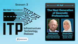


In this episode of the ITP, Roads and Bridges Staff Writer Jessica Parks interviews Scott Peterson, an associate professor of geomatics engineering at California State University Fresno and program coordinator for the Trimble Technology lab, as well as Shaaden Salem, the education program manager of field systems at Trimble, where she focuses on building the next generation of geomatic professionals. The discussion highlights how today’s technology—like GNSS, LIDAR and automated systems—is transforming the industry by increasing speed, efficiency and data collection while still requiring skilled professionals to validate and interpret results. The episode spotlights the new Trimble Technology Lab at Fresno State, a hands-on learning environment designed to better prepare students for real-world careers.
Episode length
56:12
About the guests
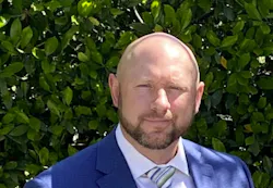
Scott Peterson is an associate professor of geomatics engineering at California State University Fresno and program coordinator for the Trimble Technology Lab.
Shaaden Salem is the education program manager of field systems at Trimble, where she focuses on building the next generation of geomatic professionals.

Here is a transcript from the episode:
JP: And welcome to the ITP. It’s just me, Jessica Parks, for now. Gavin and Brandon will be joining me on the other side of the episode. Today we have my interview with Shadden Salem of Trimble and Scott Peterson of Fresno State. We discuss geomatic engineering, labor shortage and surveyors and the Trimble Technology Lab now at Fresno State. I hope you all enjoy.
JP: Hello listeners, this is Jessica. Today I have for you an interview with Scott Peterson of Fresno State in Shaaden Salem of Trimble. Hi Scott and Shaaden, thank you so much for coming today.
SP: Good morning.
SS: So good to be here.
JP: Scott Peterson is an associate professor of geomatics engineering at California State University Fresno and program coordinator for the Trimble Technology lab. Shaaden Salem is the education program manager of field systems at Trimble, where she focuses on building the next generation of geomatic professionals. And today we're diving into the new partnership between Trimble and Fresco State to create the Trimble Technology Lab, a state-of-the-art space where students can get hands-on experience with the geospatial and land surveying technologies that power modern transportation and infrastructure projects. To start us off, I would love if one of you could explain how surveying and geospatial technology play a role in modern transportation infrastructure.
SP: Well, I'll start. I think in all sorts of infrastructure, it requires measurements, requires mapping, it requires location of everything that exists and everything that's going to be built. And so that requires that technology allows us to be able to build with high degree of accuracy and that when everybody uses the very simple idea, if you're building a bridge from two different sides, you want it to meet in the middle, and if you don't use good technology, then yeah, you're not going to make it. It'll flounder somewhere there in the middle. And so the survey side and the geospatial technology, what we have, it allows us to continue to push the transportation sector further, quicker, faster than we ever thought of in the past all the way to, we use a lot of automated control that never existed before, and it's a growing trend, but you still have those that do what we consider old school ways. And then you have those, especially Caltrans for us in California, where they're utilizing technology to simplify some of the building process to build it though with a lesser amount of air or potential for mistakes that could be made, which then creates a much safer transportation network if that would make sense. Where you don't have any humps or bumps or anything like that. You don't get little spots where when it does rain, or if it rains where you get little spots where you could potentially hydroplane or anything. Everything that's designed because designs are, we'll call that more of a perfect model, but the building of it, that's always a struggle, so if you don't have the technology to be able to build it, right, yeah, you'll introduce a lot of potential. Not saying you do, but there's always that potential for it.
SS: I think Scott mentioned a lot of good things there with the bridge example, the tunnel example. There's definitely cost involved in a lot of that rework. I like that Scott touched on the safety piece, that's really important. And then there's also the time piece that it takes to do all that rework, too. The way that I like to think about infrastructure projects and the connection to geomatics or geospatial or serving technology is things don't just appear in the real world without us. We help with connecting the digital plans and bringing it into the physical world and then as the project goes on, you are getting the physical world and your project updates as it progresses reflected back into the digital world to send it back to the rest of the team. Like this is how far we've progressed with bringing our digital plan into the real world so connecting the digital to the physical and then back from the physical to the digital is where a lot of the geospatial technology really shine. I think about one personal example for me when I was doing some construction surveying, and we were part of the process of making sure that the road was being built to plan and one of those things was making sure that the road had a specific slope so that the water, when it rains, yeah, it goes to the side of the road where it's collected or just that simple detail. I think a lot of people don't know that there's so much intentionality with how roads are built and we make sure that that slope is the correct slope, so that's pretty exciting.
JP: I agree with you. People don't understand. They think that they just come out of thin air, I think, and it's so many people, so many moving parts. You have no idea. I mean, you two have an idea, but many people don't. I guess one of my follow out questions to that is what parts of the roads, bridges or transit projects do you think rely most heavily on accurate geospatial data?
SP: That's a interesting question you put there of which one is most related to it or needed for it? I'd say all of it. It has to be the exact same. We don't distinguish or differentiate between here's a road versus a bridge versus a tunnel versus borrow pits or drainage areas or anything like that because if the whole design doesn't get built to the right specification, it doesn't work. There's always something that comes bad out of it and so whether it's something very simple where we're just providing an elevation, we provide that elevation to the highest degree of accuracy, or if I want to give a location of where a sign is going to go, we don't just tell them in general, ‘Oh, just put it where you want close enough for who it's for’. Those kind of phrases are absolutely awful in our world. We don't use them. Others do, but we never will ever say anything like that and so our goal is we will give you the very accurate location. We will measure to the most accurate location. We will do everything to the accuracy of what our technology gives. Now, what they do with it afterwards, that's up to them, but I will never go in and say, ‘You know what? I'll give it to you’. I'll throw it out there and good enough, good luck because it compounds. If my good enough is good enough for me, but then yours is good enough for you, the level of the mistakes will increase and increase and increase and increase over the duration of a project. So if you ever find any geospatial engineer or anybody out there saying, it's good enough, I'd hire somebody else and go a different direction because that's not what we do. We literally are about doing and when I talk about accuracy, precision, we're talking either millimeters, we're talking in some instances, sub millimeters on elevations we can do, so I'm not saying we're like, ‘Oh, it's within a, in people's terms to understand a couple inches or so. No, we are tight. And so from that aspect, you say which one's most important? I don't think it matters because we take whatever job it is, we are going to hit the most accurate level that you could ever imagine or expect.
SS: To add to that. Yeah, the level of responsibility that we have with just a simple measurement like measurements can have huge consequences if they're wrong, and like Scott was saying, it can get compounded and compounded, so there's definitely some serious weight to the work and the other piece is serving technology in geospatial technology is used throughout the whole life cycle of the project, from the beginning of just making sure that we know where we're going to work in the first place, the staking out the main pieces of all of it and then throughout the project progressing, you are using serving and geospatial technologies while it progresses. And then when the job is over, you want to make sure that it was designed as it was built to design and then you need to make sure that that's documented. And then when you're done, you have to come in and monitor it, monitor how is it, are things moving, are things degrading? So we see the whole cycle. And that's another piece to what Scott was saying is that each part matters to us.
SP: How Shaaden said that, where there's a huge liability no matter what happens, yes, we use the technology, but that person using the technology, that's where the liability goes to to their license. So for that reason, we're not messing around. We are not going to just try and oh, it's good enough. Because when you think about the cost of an infrastructure project, I don't have the money for that. My wife and kids, we'd be living out of boxes if anything really ever happened because I took my job as an eh, it's okay. So there's another level. And even though, yeah, we use technology for it, but there's that professional level, that engineer level that we have to stay a cut above everything else that will allow no matter what happens, we're on top of it. And not to say that we do things to be scared like, ‘Oh, I don't want to get sued. No, nobody ever does. But you have to have that level of professional workmanship and desire and then the technology to be able to make sure that that won't or it shouldn't happen if you're taking all those proper steps and doing everything you're supposed to. We talk about that we are here to provide for the public welfare, and safety is one of our biggest jobs using whatever we've got. And especially with phenomenal technology like Trimble, we use it so that aspect exists. You never want to talk about that because then people get scared. ‘Oh, I don't want to be the one signing that. I don't want to get sued’. Well, you shouldn't ever have to. If you have been trained, educated and experienced and doing all those things, you're good. There's nothing to ever worry about, and if anything, then we'll just go back to Shaaden and Tremble, and we’ll be like, ‘Hey, you got to help us out. We messed up. Can we borrow your insurance’?
JP: They're known to be quick to provide it.
SP: Yeah, they'll give me some instruments, but they'll be like, ‘Good luck, man’.
JP: So now we're going to switch into the workforce shortage issue. I understand the industry is really sounding the alarm on a better growing shortage of surveyors. What does that shortage look like on the ground and how is it affecting project delivery?
SP: I think for me, on what I see, I still work in industry, as well as work in the education field, and what that looks like is I have companies that they come to me every week and say, ‘Hey, we need somebody. We need somebody’, and they're not looking for just anybody off the street. However, because of the shortage, they are grabbing somebody that, oh, it's my nephew, it's my friend's, cousin's, neighbor's, dog's owner. They are pulling somebody and saying, ‘Okay, I'll train you sufficiently to do the work that we need you to do’, and so if we're starting at that level of just pulling somebody off the streets and trying to pull them up to that professional level of licensure of running a field operation or running something along those lines, there's that liability a little bit more in there, and so to me, it's a little scary when you think about that's what we're having to do and then you get older people that are out there that are starting to retire and get out there and so the shortage is real when that relates back to the delivery of that project. Well, now that project that once would be a month, two weeks, whatever it is, it's compounded now. We don't have, there's not enough people out there now to cover every little project, which by the way, that's still pretty dang good for the industry where you're like, ‘Hey, I'm low supply, so I can raise my prices’, but it's too much where there's a lot of projects that get delayed, delayed and delayed because you can't find somebody in a good timeframe, or you're just going to realize that, ‘Oh, it'll just have to be a couple months or whatever it is you're looking for’. And if it comes to large infrastructure projects, holy wow, that's here in California, any sort of transportation stuff, you think the magnitude of what it is, and if they can't find anybody to get the work done, that highway is going to be shut down for months or years even, or it just causes just the compounding effect and havoc everywhere else, and so I think that's what the real world is showing and saying that we need more, and technology is leading. So we've got Trimble that's right at the forefront right there that they're saying this is how you can do it, and it has absolutely helped. Years ago, if you go out into the field, we call that, to go out there and do some survey work, you would generally have maybe two or three people with you always. Technology now does allow us to go out there on your own between robotic instruments and the use of GNSS devices that we can do that on our own and save a little bit there, but even that, it's a shortage. There's so much work and yeah, it's a tough thing and so I think that's why Trimble’s involved with us, too. I'm sure I'm probably getting ahead of myself, but that's why we're involved together to try and overcome that, and of course we'll talk about that later.
SS: To add some numbers to what Scott was saying, Trimble put together a state of the geospatial industry 2025 report that has some of these numbers on a lot of people's minds. So one of the things that was included in that report was actually from McKinsey in June 2022, and it states that in the United States alone, 41% of the construction workforce from before 2020 is expected to retire by 2031. That's one number. Another number that we have in this report is based on our conversations with customers. A majority of businesses are reporting that is somewhat difficult or very difficult to find qualified workers, and 42% are saying that it's somewhat difficult and then 27% are saying it is very difficult, so with the average age of the surveyors being close to around 60 years old, the retirement rate is not being balanced by the number of people entering into the industry, and this is where this conversation between Trimble and Fresno and CSDS is very important because we're trying to address the workforce shortage from multiple angles, from the angle of making sure that they are qualified and also of how can we make these programs more attractive to funnel more people into the industry.
JP: That's my next question, So I guess I'll just ask that. Let's talk about the Trimble Technology Lab, the main reason we're here today. How will this help bridge the workforce shortage, what the technology provides and the skills students are learning?
SP: Shaaden, I think you should continue on with what you were saying. I think you're going in a great direction right there.
SS: Thanks. Well, it's all the work for shortage, so one of the things that we talked about earlier in the podcast is this idea of the weight of the responsibility, and sometimes it's a little scary and one of the things that we want to address with this partnership is being able to instill confidence in the next generation. That the next generation feels confident to do the work and do it well with the technology that can get you there. So a lot of schools are still stuck teaching some of the fundamentals and the older way of doing things that are important to know, but if that's all you teach them, then there's a big gap between what they are taught with during their schooling and then when they graduate, there's that, it's almost like a chasm that they have to jump over to be ready to provide value to the company that hires them, so the company is like, well, now I got to teach you all over again how to do things our way or the way that it's done in the industry and that isn't the best way to instill confidence sometimes. Imagine yourself, your first real job, and you feel like you don't know anything when you just graduated, and your school was supposed to prepare you for that, so when you learn, you want to be able to learn during your school where the consequences are low. It's okay to mess up, but then when you go into the field in your job, learning on the job has consequences, and there are different ways that companies try to mitigate that, and at the same time, we want them to feel confident. So with schools, like partnering with Peterson here in Fresno, we are making sure that they have the latest technology so that not only are they learning the fundamentals, they can progress with learning how to do the job with the latest technology. And then the important piece is the connection between the two. Can they assess new technology as it comes out? Because technology's always going to be changing, but if you equip your students with the mindset, the critical thinking of how to ask the right questions, how to assess new technology so it's not daunting to adopt it, then you're set up for a confident successful career where you aren't afraid you're ready to tackle new technology and new challenges. I'm going to pause there and let Scott pick it up.
SP: I think that's great, and it is true. Our goal here at the university is to help these students know that this isn't just a technical field, you have to know how to test it. We try and teach them, okay, well this is okay. We have to go through those basics. You turn it on all the way back to the very beginning and put batteries in, but beyond that, as Shaaden alluded back to the idea that we still have a lot that say, ‘Well, this is how we used to do it back in the day’, and they don't want to give up on that, but they forget that how they did it back in the day they did it that way because that's where technology was, that's all they had, so of course that's what they learned on. As we have phenomenal technology, it's mind blowing the things that we can simplify and do; that's not necessary anymore. So now that we have this kind of technology, we have tools that in a different way simplify things, but it also makes it harder. It makes it harder to figure out, well, okay, what is the pure accuracy? Like before, I could pull a tape measure. That's pretty obvious, I know what I'm measuring. Now, we're relying on GNSS satellites, we're relying on robotic instruments that are tracking following, and we have to then be smart enough to know, is everything working? How do I test it, how do I analyze it? And as Shaaden said, how do we assess the value of all those things? So having now the technology here, that's the crux of every survey program. Technology's expensive, and it is for a reason because it does so much, and it is critical for what we're doing, but for schools, we don't have the money to invest in those things. Every year as it changes and so you do end up with some programs that are behind the times, and if they're learning on older technology or even older versions or ways of technology, yes, that's absolutely true. Their confidence to get out in the real world may not be there or their excitement for the real world doesn't exist either. And so this really truly is giving them some excitement to see what they're going to be able to play with. I say play, but I mean using in the industry and their profession, but we are to a degree and not to make light of anything, but yeah, we are adults that play with toys. We're adults that play with laser firing tools that are doing all these things, and it's a blast, but the mind has to be there. The education has to be there or the training has to be such that it's covering those things that whatever happens in the outside when you're measuring or doing things, if you are prepared no matter what, and you'll recognize it, spot it that we have such things which are anomalies within the measurements from satellites, and if you don't know what that means, and you don't know what's going on, that there was a drop in one satellite, or your precisions changed, and you didn't care, you didn't look at it, didn't know what to do, there is where you get in trouble, but that education with the newer technology of how it works, it does. It instills this, I got this, I could figure it out, and it's pretty awesome.
SS: The toys piece is, I think another part of how are we trying to address the workforce shortage is getting more people into the programs, and the toys piece definitely does attract people into the program. I was talking to a student, and I was asking him, ‘What made you choose geomatics engineering? Why did you choose this degree’? And he was saying, ‘Well, I was actually in another degree but then I got exposed to the robotics of what geomatics offers, and that's it’. He was sucked in and so that was one of the reasons why they switched over, and they chose geomatics is because of the technology, and we have to highlight that what you end up working with is cool, is fun.
JP: That's actually so funny. You guys keep leading right into my next question. So speaking of the toys of the technology, my next kind of question was, so Trimble, you did donate an impressive amount of tools from GNSS, laser scanners, total stations, different software. Can one of you share some examples of how these tools are used on real transportation projects? For instance, highway mapping, bridge assessments or construction layout?
SP: Absolutely. I'll jump in if that's okay, Shaaden, to start and whatever I miss, you can cover me. So we'll start with GNSS. So that's what everybody commonly just refers as GPS, that's what we call that, so using satellites to precise locations. That right there, when you look at the overall transportation, transportation projects are long, and if we go back to that same idea of old school technology and old school ways, you pull a tape measure, so to say, of 100 feet at a time, that's going to take a long time, and to make sure it's calibrated, make sure it's in the right direction, everything that goes along with there. So the GNSS gives us, you can go as far as you want, you can go as close as you want. The accuracy doesn't change because I went 10 miles versus I went 10 feet all the way down to .100 of a foot. It doesn't change, so the speed at which we can take our designs and put those out onto the real world, it's phenomenal, so there's an aspect that we, Shaaden alluded to this earlier, we are involved on the before, the during and after. The before, we will map out an area, either if it's undisturbed land, this is where we're going to design on, or we're going to go map out an existing highway or structure, whatever it may be, to then do a design on. So out of all the tools that are existing out there from GPS to robotic total stations, to LIDAR scanners to mobile mapping, we look at all the different technology that we have. What's it going to take to get this done and to be done at the most accurate position possible? So we want to do some monitoring of a large highway, a long highway, so we will then employ, so Trimble has their latest MX 60, it's their mobile mapping unit that it measures everything all at once. You drive down the highway at 65 miles an hour, 70 miles an hour, whatever it is, and with the LIDAR that's on there, the GPS that's on there, the scanners, the distance measuring, every little thing you could think of down to the IMU inside of there. I mean, you get data that it would've taken you, oh my gosh, months, and you just wouldn't have gotten it and the amount of data even crazier is that before I could measure one specific point at a time. Well, now we have technology with LIDAR or what they call slam simultaneous location with the mapping is we are talking millions of measurements now, so this idea that we're still just very picking things, and you have to infer between measurements, no, we know exactly where things are now, and so on those highway projects, that's what we're looking at, so it's either the mapping beforehand, it's the staking of how to build it. We tell them where to build it, we tell them what elevations to build it and what offsets to build it. We don't tell them how to, that's on those guys that do that job, but we are completely immersed into this whole project just like anybody else, and we're the ones that are verifying that, no, that's not going to work. That's not the design. You're off, or you're wrong, or you're right, or everything's working just as it is. I'm sure that didn't go quite deep of the specific technology you're looking for, but it's hard to say on any one project that you want to go far, okay, we're going to use GPS. You want to go really close, we're going to use a robotic instrument that needs to measure things that you can't visually see. So then we get down into culverts, we get down into drainage systems that again, and everything is all coordinated together, so whatever system I want to use, I want to use a drone to map the aerial, so I see what I'm looking at. Then I want to use the mobile mapper to get the whole layout of the ground. I want to use a robotic instrument to get the very specific locations of things that I need to measure and then GPS is thrown in there to be able to simultaneously places where we are. I mean our world revolves around where of where we are and then describing that where so every bit of technology we have on any transportation project. These projects, they flow easier with a lot greater degree of confidence and that the work is going to be good because of the newer technology that exists.
JP: And that's so interesting, and I was looking at AI is not something that replaces the workforce, but it's something that enhances, it expands the amount of workers you have and how can their capabilities be pushed even further, and I think that's exactly what exactly example of how I see AI and technology innovating the industry. My next question, I think we have time for two more questions. So one of my questions is, can students now simulate or replicate real projects and errors in the lab? What does that look like? How are they getting this real world experience, seeing real world situations?
SP: Absolutely. Now that we have, so like I said before, having the technology was a crux. We never could do everything that we wanted to try and do so given that we have that the simulations come when we go out and measure just a smaller road or we measure an area. We map an area, we do all those things and the principles are the same no matter if I'm doing a small area or a large area, and I think that's the kind of the cool part that if you can simulate this area, then you can simulate anything else that you're doing and now we can. Through the labs that we have throughout our curriculum, we're going to go out there, and we will take them a robotic instrument and a scanner, and we will scan everything. We'll model everything from the software that's been provided to providing an output of this is what somebody would want, this is what somebody else who needs the data to design on. This is the kind of stuff that they need, and we'll utilize, so the labs we will continue to update. We'll continue to design them given the technology that we have, so you go to some other schools that they're little, we'll say behind the times a little bit, but for us, and Shaaden’s been really awesome, all Trimble’s been really awesome to understand that I'm not going to change everything in one week and say, ‘Okay, now everything's done’. We're trying things. Now that we have it from our standpoint, it still takes a little bit to get them confident to use to knowing how to do all these things, but we're going to go through it and we're like, that was awesome. Okay, now we see where we can jump forward and move on to the next level, and Trimble, they've been so awesome. They're like, ‘Oh, well, if you come up with something, you realize you need something else, and we need to do it differently, hey, let us know. We'll do it’, and I'm not trying to put words in Shaaden’s mouth at all by claiming, ‘Oh yeah, they told me another 20 million next year’. No, just because I said so. But my point is the collaboration that we have is just that we do want to simulate more real things we want to simulate, and it's still that confidence that Shaaden mentioned earlier, it's awesome that we can do that, and no project is too big, too small, too uncorrelated. It all relates together, and so to me, I think that's what we're able to do more so than we ever could in the past.
SS: And yeah, he didn't put words in my mouth. We do have a very good relationship. We do want to make sure that what is provided makes sense to the student population and the professors. To add to what Scott was saying, the products that we did provide help simulate multiple phases of a project, so we gave the field equipment and then we also gave the office equipment, and we want to be able to have these students know the different parts and phases of a project. What is it like from working in the field and then working in the office and how do things connect together? How does the workflow connect to each other? That's something that is very important from Trimble’s perspective, is that when these students graduate, we see them as the future decision makers, as the people that need to look at a project and know that this piece needs to translate over seamlessly to the next piece because during their school and during this lab environment, they did it all, so that's one of the reasons of how we put together this package. It's not just the field equipment, it's also the office software and trying to be able to make sense of things like huge point clouds at the point where we have so much data these days, the other, the next advancement is how do we make sense and take out important information from the data and that we're not lost in it? And that's part of the solutions that Trimble provides.
SP: And to add onto that really quick is the software that was given, again, it's not just a technical nature of just, oh, turn it on, and it'll just spit out the answers. Well, you're right. You could push a button, you could tell it to do this or that, but you have to again know what you're looking for. So having now that technology, we're shaping it in such a way that our classes teach you how to calculate certain things to derive the overall precision or accuracy of a project, so we know those things. So instead of doing that by hand, now we can utilize the software that allows us to do that, but when it spits out this report, or it does certain things, we, wow, we get all this information, and I look at it and be like, ‘Hey, something happened here. Something didn't happen here’, or as they're learning these things, they're learning what to look for and where to find that. These are all, again, the same things we would've done before. It's just now it's either some parts are automated, but you don't take away, like you mentioned Jessica, talking about AI, what it can do. It's phenomenal what it can try and come up with but just because it can say that doesn't change that we are the ones looking because every project is different. Every bit of data had some sort of dependence on anything else, and to me, I think that's one of the most wild things or awesome things about this industry is any survey project we do is different. Everyone, okay, ‘Oh, I'm going to go monitor a dam today’. I'm going to make sure and tell you that, ‘Hey, this dam is sinking’. Oh, we better run, or we're going to say it's solid. I'm going to tell you that this building is not leaning. I'm going to tell you that it has a little bit of sway of motion of what the extents are back and forth to ensure that it's within the specs and standards, so every little thing is different. There's a lab here at school that is one of the construction labs, and they have to create a little foundation to put a little shed on top of it. I walk by that every day. I look over there, I'm like, ‘Oh my gosh, that does not look level’, and they're learning. It's okay. They are learning, but I grab my students, I'm like, ‘Hey guys, we're going to do something fun today and real world. We're going to go over there, and we're going to measure the elevation of their forms’, and then I come back and I tell them, ‘Woo-hoo’. Yeah, they're off, and that's okay, but that's the thing is no matter everything we're doing, it is different. So then you have the technology, the software, then to analyze all those things and you begin to see it. You begin to know what I can do, how to do it and it's amazing. It's absolutely amazing to be able to do that.
SS: If you want to tell somebody with confidence that this building is moving and swaying to this degree, then you need to be able to rely on your equipment and your tools, and for you to be able to rely on your equipment and your tools, you need to be able to assess your equipment and your tools, so this is why the partnership between the university and Trimble equipment and CSDS helps with that whole package of like, ‘Okay, how do we assess our tools’? And then how do we feel confident enough to rely on them? Something that I love telling people who aren't very familiar with our industry is just even the simple tool as the tape measure that Scott has mentioned a few times. So a lot of people don't assess their tools, but in this industry, you have to assess your tools. Something as simple as a tape measure, you have to think critically about it. You can't just rely on a tape measure. If you want to think about your tape measure and the reading that you get out of it, you have to think about things. Well, was the tape measure sloped when you stretched it out? Was it a really hot day that maybe the tape measure actually expanded a little bit and the measurement that you're reading is not actually accurate? These are things that we have to think about but a lot of people don't think about those things, so we have this practice of being able to assess our tools in a way that we don't just take answers at face value, and that's the differentiation between maybe some other people that have not been trained through a geomatics program. They might take any of our technology and just press buttons and then not understand that maybe you press the wrong button, and it's actually giving you something different than what you think it's giving you, but if you know how to assess what you're doing and the technology, then it helps with making sure you're doing things right.
JP: I think that's such an interesting example. I wonder how many measurements I've gotten wrong because I definitely use my tape measure on a slope sometimes. My next question is going to be the last question. I'm really excited to hear about this one. What has been the early reactions you've seen student projects or unexpected outcomes from this partnership?
SP: From my perspective, it's unreal that from years ago, the students wouldn't ever come to me to say, ‘Hey, I want to go practice. I want to get out there and do more’, right? They're busy. They have classes, they have their jobs, they have so many things going on. No, these students are like, ‘Hey, can I borrow the equipment? Can I take it out? Can I go practice with it? Can I go run this’? Yes, I love that, so I'm constantly, okay, just opening the lab back up for them. I'm constantly giving them my key. ‘Okay, go grab it. Go take this locker, whatever it is’. And these kids are, I call them kids, sorry. These young adults or these young geomatic engineers kids are, they're very grateful to see that and partly I'm sure it's coming. Every time I talk about it, I'm telling them we need to be grateful for this. We need to be respectful of it. We need to understand what has really happened for you today to make this work, so I instill that in them. But then they turn around, they're like, ‘When are we going to get to use the scanner? I haven't used it yet. When are we going to do this?’ Okay. I'm like, ‘Alright, we're almost there. We're getting close’, so they're seeing things in the real world, and they're like, ‘I want to get to that point’, and so it's a level I haven't seen in the time that I've been here of students wanting to do these things. They're senior projects now that we're doing, so that's the culminating project they do at the end of their career here. Their ideas these days are much more in-depth and involved now because like, ‘Oh, well, I want to use this technology and this and this’ and then we get to really start playing it out and having them test things or do certain things that we couldn't before, and they're excited, they're confident. Like I go, sweet, I get to use it. I get to do this, which they couldn't do before, so I love it, and then at the other side of it is, so we have a conference every year, and at this conference, we get our industry, we'll call them industry partners, whatever, but just those that are alumni of the program, those that love the program, those that want to support the program, they come in, and they're like, ‘Wow, you guys have all this technology.’ it was pretty sweet actually. Every bit of equipment that we had, I took it all and just, it's a sea of yellow boxes. We set it out. I was there.
SS: I saw it.
SP: Yes, sea of yellow boxes and everybody's like, ‘What's all this?’, and they thought Trimble just brought it, and I'm like, ‘No, this is what they gave us’, and they were in awe, and so now their level of excitement is also sweet. They're going to come out ready to start doing things. For my internships that we offer, I'm going to hire this kid. It's going to be a much quicker out of the box. I know they can do certain tasks and things without having to worry so much or spend so much time on myself to train, and so the reactions are awesome, even to the degree that I've got to say when it's one thing when you have, at this point, I'll call Trimble our benefactor for a minute, right? The rich uncle. But sometimes when companies or people donate or they offer assistance, if they're not really seeing the gratitude from those receiving it, they're not so excited, but the whole time when Shaaden was there, when Brian Bert was there, when CSDS was there, when we had Boris that was there, all I saw were smiles and not just a smile like, oh, it's a pleasant smile. No, it's an excitement. You can really feel it and every time around Shaaden, I mean she's just got energy up the wazoo of just, this is so awesome, and I can't tell you how grateful I am for that because they, too, instead of me just like the little kid of the receiving side, they're also like, ‘We want this’. I want to see, and we are willing to do whatever it takes to help make this work, and they show that excitement, so I know that's not directly to just doing projects, but I mean that reaction I think is warranted to see everybody is seeing this and more, so I can't tell you how awesome it is that those that are affiliated with Trimble are more so I think excited than I am, so I got to work on my side and be like, this is great, but it's really incredibly phenomenal experience that we have something like this, which doesn't exist in any other program in the U.S. or in the world. This is truly amazing.
SS: I'm really happy to hear about the student excitement and them wanting to use this technology and they're angsty to get started. That is super awesome to hear. When we were at that conference, one of the things that I had heard while people were walking by the old yellow boxes was something I had written down in my phone. I thought it was hilarious, And I think it was a student that said, ‘I've never seen this many yellow boxes in my entire life’ And so that just that there were a lot of yellow boxes, and it really got people's attention, So it was a great talking piece for sure.
JP: I am so grateful for both of you coming onto our podcast. I feel the energy just coming through your voices. I wish I was in college, and I could be a part of the Trimble Technology Lab because I think it would be so fun to work with the both of you. I'm so jealous.
SS: You’re changing careers now.
JP: Yes. But thank you guys both so much for coming on. I am sure students learn so much from both of you from this partnership. I am sure it's going to have a great impact, and I'm really excited to see how everything goes down the road, so thank you both so much for coming on.
SP: Thank you.
SS: It was a pleasure being here. I do want to just add on as well that a third party that was super important in this whole package is the CSDS, our geospatial dealer that is located locally. That is a huge piece of making sure that this partnership is successful, so they're going to be on the ground representing Trimble and making sure that Scott and the team in Fresno State is comfortable with the equipment and trained on it and confident on it, and they couldn't be here today with us, but they are super, super excited. Their excitement level is higher than all of us, so it's really, I just want to shout them out and thank them for everything that they're doing, too.
JP: Thank you, CSDS, we appreciate all the work they did, too. So thank you both so much, and we appreciate you being guests of the podcast. It's been a pleasure speaking with you both.
JP: And we're back from my episode with…
GJ: Your episode?! Whoa, whoa, whoa.
JP: I'll start that again.
GJ: Hold on. Let's keep this in. We're rolling, we're keeping this in. This is the Jessica Parks episode, everybody. Alright, we're back from the interview. That was a really great one on the Jessica Parks episode.
JP: Hi. Yes. Well, we are back from my interview with Shaaden Salem of Trimble and Scott Peterson of Fresno State. They were so captivating. I told them at the end that I would have loved to take the class. So what did you guys think of the interview.
BL: Well, Jessica, before I get into my thoughts, let me just say I'm not going to let this podcast episode go without saying that it is a Tuesday, and it is podcast day, so we need to make sure that we get that in first. But yeah, really interesting stuff from you and my biggest takeaway from this, and this is what really sort of made me stop and pause and think for a second, is when Scott talked about the importance of safety, and he talked about all the stuff that Trimble does and the infrastructure, and he basically says that we do all these projects, we build all this stuff, and if something happens, we're liable for it, and he basically said if something goes wrong on a project that I'm responsible for, I'd be living out of a box, and I think that it really comes down to the importance of getting things right. We always talk about infrastructure, technology and how we're using this stuff to build things and how great these companies are, but we are trusting that all infrastructure around us, whether it's bridges, whether it's roads, whether it's a simple railing, is safe, and it really puts into perspective that the people that are building these things, we're trusting them to make these things last for decades and decades.
GJ: Yeah, absolutely, and it's just we love Trimble. Great company. And the Trimble Technology Lab on this campus is very valuable. And also it's really important to talk about the geomatics and the geomatics engineering program and how crucial that is to getting roads designed, and you guys talk about that in the interview, and it was really interesting to hear. I mean, every inch matters, every degree matters, all the angles matter. And yeah, Fresno State is really lucky to have this lab, and I wish there were more of them.
JP: Definitely, and I think it was really interesting, too. It's a unique way to address the labor shortage of surveyors because this class of students will come out already knowing how to use the technology going, and they're able to go right into the field, so I think that's a really interesting way to address that issue.
GJ: One of my college roommates was an engineering major, and he had a summer job where he did surveying. I think that it's a really great way to get younger people into the industry. Back then, I had no idea what surveying was, and I remember meeting up with him once, and he was just standing there with a clipboard and some guy was looking through a thing, and I'm just like, ‘What are you doing’? And now I understand a whole lot better, but that's the thing is, and even you mentioned it in the article, in the interview, that the regular public does not understand this at all. At all. And it's so crucial to getting the roads perfect.
JP: Definitely.
GJ: But so much of that, there's so much in life that we don't understand the nuts and bolts behind the thing. That's the way it is.
BL: We're just living.
GJ: Yeah, we're just living.
JP: Diving the roads, driving the bridges. Trusting. We're trusting,
GJ: Right? I mean, on the Mass Transit side, I couldn't tell you how they come up with bus routes. There's a science behind that, right?
BL: Yeah, no, there is. It's all based off number of passengers, frequency miles, how much a certain bus can hold. And the same thing when it comes to trains and railroads and all that.
GJ: And the normal person just stands at a bus stop and just goes, ‘This bus is two minutes late. What the heck’?
JP: I didn't even think about that, too. My dad was a dispatcher for waste management, so he built the routes and everything, but I didn't think about that with a bus. The added factor of how many people are going to get on, so you can't have it be five super congested spots in a row. I thought that. That's interesting. I didn't think about that.
GJ: Should we have your dad on?
JP: He would be so shy. He is the opposite of me. He is not outgoing.
GJ: Not outgoing. Okay. Alright.
JP: I get it from my mom.
GJ: Okay, well that would truly be your episode if we had to have him on. Alright, well this has been another wonderful episode. Thanks to Jessica Parks for that great interview. Brandon, how can they find us? Where can they email us?
BL: They can email us at [email protected]. They can also check out Mass Transit and Roads and Bridges on all the socials. X, Facebook, LinkedIn, Instagram. So make sure you go and follow us and if you have any questions that you want to ask, hit us up.
GJ: Follow us on Instagram. What are you doing? I know you're on there looking at reels. Why don't you follow Mass Transit and Roads and Bridges, too? We will make some reels. We'll send you some reels. That's how we'll show our love. We will send you guys some reels. Alright. Thank you to Endeavor B2B, our parent company for giving us the platform to create this podcast, and thank you to Karina Mazhukhina, the one who is our producer and editor. And thank you to Jessica for that interview. Again, thank you to Fresno State and Trimble. For Brandon Lewis and Jessica…
JP: And thank you to our listeners for listening to my episode.
GJ: Yes, thank you. Thank you for listening. Alright. For Brandon Lewis and Jessica Parks, I'm Gavin Jenkins, and we will see you later. Goodbye.
About the Author

Brandon Lewis
Associate Editor
Brandon Lewis is a recent graduate of Kent State University with a bachelor’s degree in journalism. Lewis is a former freelance editorial assistant at Vehicle Service Pros in Endeavor Business Media’s Vehicle Repair Group. Lewis brings his knowledge of web managing, copyediting and SEO practices to Mass Transit magazine as an associate editor. He is also a co-host of the Infrastructure Technology Podcast.